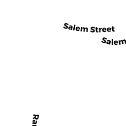
525 SALEM ST
Owner Information
FORMER SOUTH SCHOOL
TOWN HALL
LYNNFIELD, MA 01940


Property Details
525 SALEM ST is classified as a (formerly Municipalities/Districts. Removed June 2009.) (School).
The primary structure on this property was built in 1950. There are 23,621ft2 of built area within this property. There is 23,621ft2 of residential/living space within this property.
525 SALEM ST is valued at $6,001,400. The land is valued at $2,961,400 and the structures are valued at $2,968,900. There is an additional valuation of $71,100 on this property.
This property is in Zone OP. Confirm with local Zoning Board authorities to ensure there are no overlays or other easements on this property.
The most recent deed for 525 SALEM ST is recorded at the local registrar in Book 3453, Page 196. 525 SALEM ST was last sold on Wednesday, April 24, 1946 for $0.
Assessment data from fiscal year 2022.
Flood Data
According to the FEMA National Flood Hazard Layer, this property does not appear to be in a flood zone. It may also be in an area not yet reviewed. Nonetheless, confirm this information prior to taking any action.
To view the flood hazards around this property, create a FEMA "Firmette" Map of the area around 525 SALEM ST.
Broadband Internet Providers
| Provider | Type | Bandwidth (mbps) | |
|---|---|---|---|
| New Horizon Communications Group Inc | DSL | 3 | 0 |
| MCI | Copper Wire | 0 | 0 |
| FirstLight | Fiber | 0 | 0 |
| CenturyLink | Copper Wire | 0 | 0 |
| VSAT Systems, LLC. | Satellite | 2 | 1 |
| Viasat Inc | Satellite | 100 | 3 |
| HughesNet | Satellite | 25 | 3 |
| Verizon New England Inc. | DSL | 5 | 0 |
| Verizon New England Inc. | Fiber | 940 | 880 |
| Comcast | Cable | 1000 | 35 |
| Fusion | Cable | 0 | 0 |
| GCI Communication Corp. | Satellite | 0 | 0 |
Broadband service provider data from December 2020.
Adjacent Properties
- 527 SALEM ST
Residential Condominium owned by BEAVER GARRY M T/E - 527 SALEM ST
Residential Condominium owned by DE PALMA LUIGI, T/E - 527 SALEM ST
Residential Condominium owned by BAKER SHELLEY - 527 SALEM ST
Residential Condominium owned by SNEIRSON GERALD M T/E - 527 SALEM ST
Residential Condominium owned by UMANA MARIO, T/E - 527 SALEM ST
Residential Condominium owned by MARK M MARTIN 2010 TRUST - 527 SALEM ST
Residential Condominium owned by SILVER VIRGINIA A, J/T/R/S - 527 SALEM ST
Residential Condominium owned by WILLIAM W WOLLINGER 2019 REVOC ABLE TRUST - 527 SALEM ST
Residential Condominium owned by SCARFO FAMILY TRUST - 527 SALEM ST
Residential Condominium owned by DANIEL HUGHES REVOCABLE TRUST HUGHES, DANIEL/CHERY - 527 SALEM ST
Residential Condominium owned by CATRACCHIA ROMEO, T/E - 527 SALEM ST
Residential Condominium owned by ANZALDI REALTY TRUST - 527 SALEM ST
Residential Condominium owned by BEVERLY D DEVIRGILIO FAMILY TRUST - 527 SALEM ST
Other, Non-Taxable Condominium Common Land owned by WINDSOR COURT LLC - 527 SALEM ST
Residential Condominium owned by 115 CALDWELL FARM TRUST - 527 SALEM ST
Residential Condominium owned by FICI REAL ESTATE TRUST - 527 SALEM ST
Residential Condominium owned by RAMSEY JOHN T T/E - 527 SALEM ST
Residential Condominium owned by JACIR NABIL N, T/E - 527 SALEM ST
Residential Condominium owned by RODMAN ELISE F - 527 SALEM ST
Residential Condominium owned by KAPLAN JANA M, T/E - 527 SALEM ST
Residential Condominium owned by COOPER ALANA G J/T/R/S - 527 SALEM ST
Residential Condominium owned by JAMGOCHIAN GERALD J, T/E - 527 SALEM ST
Residential Condominium owned by SCHENKEL ROGER L T/E - 527 SALEM ST
Residential Condominium owned by BIRMINGHAM THOMAS J, T/E - 527 SALEM ST
Residential Condominium owned by JAMES W AND CAROL M FLINT LIVING TRUST - 527 SALEM ST
Residential Condominium owned by ROSANN M SILLARI 2009 REVOC TRUST - 527 SALEM ST
Residential Condominium owned by THOMAS H LUTZ JR 2001 TR THOMAS H T/C - 527 SALEM ST
Residential Condominium owned by ANNA JANET SANTA T/E - 527 SALEM ST
Residential Condominium owned by ROBERTO MARK C, T/E - 527 SALEM ST
Residential Condominium owned by BAILEY KATHERINE AGNES - 527 SALEM ST
Residential Condominium owned by PICCIOTTO MAUREEN J - 527 SALEM ST
Residential Condominium owned by EATON JOHN K, T/E - 527 SALEM ST
Residential Condominium owned by RONDA F SPITZER 1999 REVOCABLE TRUST - 527 SALEM ST
Residential Condominium owned by ANNA P MORELLO TRUST - 527 SALEM ST
Residential Condominium owned by LECLAIR DONALD R, T/E - 527 SALEM ST
Residential Condominium owned by RYAN MARTHA H - 527 SALEM ST
Residential Condominium owned by RUDOLPH EDWARD P, T/E - 527 SALEM ST
Residential Condominium owned by CARNEVALE LINDA - 527 SALEM ST
Residential Condominium owned by WHITNEY HOLYOKE L, T/E - 527 SALEM ST
Residential Condominium owned by MANDELL FRED, T/C - 527 SALEM ST
Residential Condominium owned by MARIE I PALERMO REVOCABLE TRUS - 527 SALEM ST
Residential Condominium owned by WALLACE FAMILY TRUST - 527 SALEM ST
Residential Condominium owned by MILDRED C. TASCHETTA TRUST - 527 SALEM ST
Residential Condominium owned by SICILIANO FAMILY IRREVOCABLE TRUST - 527 SALEM ST
Residential Condominium owned by MOLLOY NOMINEE TRUST - 491 SALEM ST
Single Family Residential owned by PIRES EDWARD C.